Weather Station
Research activities
-
FORETHIR: FORest Evapo Transpiration at High Resolution
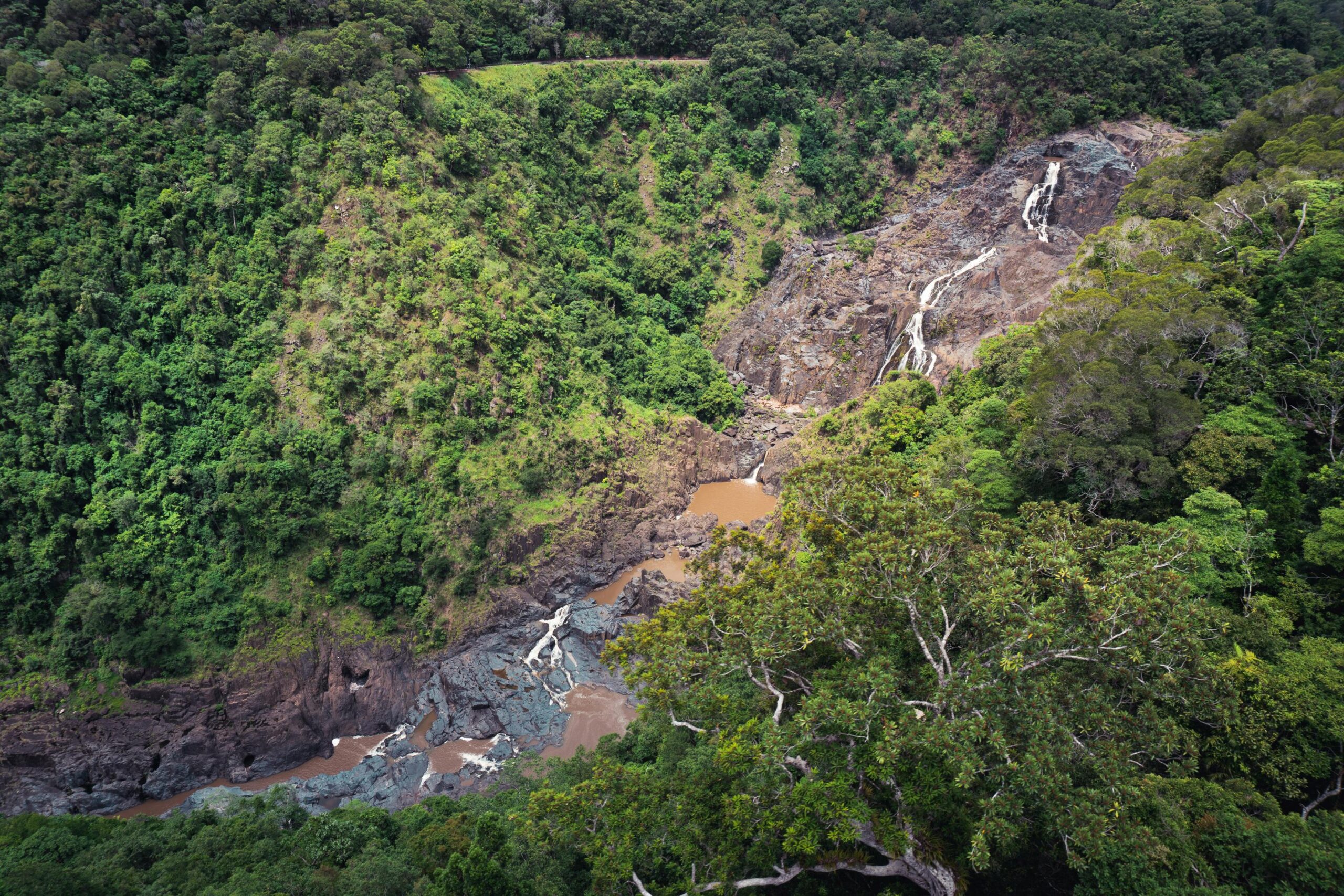
FORETHIR is a Forest and Wood Product Australia (FWPA)-funded research project, initiated in 2019 with UniSA and 2023 with Curtin University. It includes research partners and in-kind contributions from Curtin University and the University of South Australia. The Curtin node dedicates itself to developing the FORETHIR tool, which delivers high-resolution forest evapotranspiration products from space. This tool aids in the sustainable management of water resources by providing accurate totals of plantation and groundwater usage, along with insights into forest health. FORETHIR offers 10 metre resolution daily satellite derived products. These products have been calibrated and validated (cal/val) through an extensive field monitoring campaign in Pinus Radiata and Eucalyptus Globulus across the Green Triangle of South Australia. The validation process is now extending to various forest environments in Western Australia.
-
- Curtin Contacts: Dr Eriita Jones [Remote Sensing Lead]; Prof. Joseph Awange
-
- UniSA Collaborators: Dr Baden Myers; Jeff Lawson


-
-
Eyes on Australian Forests
The Australian Space Data Analysis Facility (ASDAF), in collaboration with SSTC and UniSA STEM researchers, developed the Eyes on Australian Forests tool. This tool is designed to lower the barrier to access Australian satellite data, making forest satellite data products and insights more accessible to everyone. The Eyes on Australian Forests tool is currently in beta. The tool is available to anyone interested in understanding or monitoring the health of their local Australian forests.
-
- Curtin Contacts: Leigh Tyers and Calvin Pang [Data Scientists; Curtin Institute for Data Science]; Dr Eriita Jones [Remote Sensing Lead; SSTC, EPS]
- UniSA Collaborators: Dr Baden Myers [UniSA STEM]

-


Explore more
Publication
Check out our publication reviewing policies, codes, and guidelines related to the management of wetlands within plantation forests in Australia and New Zealand. We examine the prescribed setback and buffer distances, the reasons behind them, and the evidence supporting their benefits.
Myers, B. R., Jones, E. G., O’Hehir, J., & Lawson, J. (2022). Setback distance and management for wetlands in plantation forests – a review of policy and practice in Australia and New Zealand. Australian Forestry, 85(2), 60–70. doi:10.1080/00049158.2022.2073741.
Workshop
Australian Space Data Analysis Facility (ASDAF) has been working with Dr Eriita Jones from the Space Science and Technology Centre at Curtin University to develop the Earth Observation tool, designed to make satellite imagery more accessible and enable non-expert stakeholders to discover valuable insights into their local forest areas.
This training program includes an introduction to the tool, a live demonstration, and a hands-on workshop, presented by the technical team at ASDAF and Curtin Institute for Data Science.
Access the workshop content here: